'Land tenure security is a cornerstone of sustainable development. If people don´t have tenure security, they are less likely – or less able – to invest in their property. If a farmer isn´t secure in his land rights, for example, he might not be able to invest in soil improvement or mechanization,' explains Rohan Bennett from ITC, the coordinator of its4land, a Horizon 2020 project, which includes eight partners from the EU and East Africa and was officially kicked off on the 26th of February 2016 at the UT.
Mapping millions of unrecognized land rights
The goal of its4land is to develop tools to make land rights mapping faster, cheaper, easier and more responsible. 'We are working with three case countries - Ethiopia, Rwanda and Kenya -, all of which have different land rights mapping challenges that impact upon millions,' says Bennett.
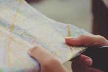
'Rwanda has a lot of small holders with tiny farms, where they grow their own food. Over the last decade, the national government used satellite imagery to create a tenure registry, but now has the challenge to keep it up-to-date. Kenya has a different story. Many of those living outside urban areas are nomadic pastoralists: along with their herds of cattle, they travel across grazing lands throughout the year. Kenya has adopted policies to protect this nomadic way of life, but how do you map dynamic land rights? We will try to do that using a range of imagery sources and smart sketch maps – in which our partner in Munster University specializes. They are creating software and technologies that enable transformation of hand-drawn sketch maps into computer ready maps. Thanks to that, the local people themselves could sketch a map to show through which areas they travel.'
'Fly and Create'
Turning sketch maps into proper, metric maps is already one example of the seven tools that the project aims to develop. Another tool, called 'Fly and Create', revolves around using UAV´s (drones) equipped with cameras to capture high-quality images of selected regions. 'This method is low-cost and very fast. You can take the pictures, land the UAV and immediately download the images to make a mosaic, an overview of the area. This data can be obtained within a day and shown to the local community, which can then help create the land rights map right on the spot,' describes Bennett.
To make land rights mapping easier, its4land project partners also want to use readily available satellite and UAV imagery to find property boundaries, such as fence lines or tree lines. 'We want to create, test, and adapt algorithms and software that can detect land rights boundaries automatically. In recent work we’ve repeatedly found that around 70% of all property boundaries are visible,' explains Rohan Bennett. Besides technological advances, the project will develop governance tools, capitalization tools, and a tool for conducting needs assessment.
Transcending continents and societal levels
'This project is all about transcending,' points out Bennett. 'We are transcending countries and continents. It is quite unique to have a consortium that involves partners from the EU and Sub-Saharan countries. We are also transcending disciplines, our partners bring in expertise in various technology fields, governance and innovation. Finally, its4land transcends different technologies and societal levels. The tools are not meant only for the governments, but have to be acceptable also for the local communities, who will have access to the resulting maps. A really important aspect is to ensure the developed tools compare favorably against gender evaluation criteria. We are making sure to create tools that are fit for their purpose.'